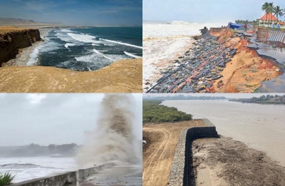
<br>ISRO’s Space Application Center’s 2021 research on ‘Shoreline Change Atlas of the Indian Coast- Gujarat- Diu & Daman’ by researcher Ratheesh Ramakrishnan and other researchers has found that “Gujarat’s 1052 km coast is stable, 110 km coast has eroded and accretion is noted on a 49-km stretch.”
It has also pointed out that because of the rising sea level and climate change, “Gujarat state is estimated to have gained an area of 208 hectares of land due to deposition of sediments, while due to erosion the state lost an area of 313 hectares.”
Another research by Krunal Patel and others, 42 years of observation, is that the “highest coastal erosion took place in Kutch district, state’s 45.9% coast is eroded.”
Patel and others have categorised, “Gujarat coast in four risk class, 785 kms fall in high to very high risk level and 934 km in moderate to low risk category due to anticipated rise in sea level.”
According to this research, “Among 16 coastal districts, 10 districts are reported to be suffering from erosion, highest in Kutch, followed by Jamnagar, Bharuch, Valsad, this is because of increasing Sea Surface Temperature (SST), in Gulf of Cambay (Khambhat) it is highest 1.50 C,A Saurashtra coast 1 C and the Gulf of Kutch 0.75 C in the last 160 years.”
On the ground, villagers and citizens have started burning their fingers. In 1969, Ahmedabad district’s Mandvipura village’s 8000 villagers and 800 of Gundala village of Bhavnagar district had to be rehabilitated because agricultural land and some parts of the village had been drowned under sea water, remembers Pradyumansinh Chudasama, a social worker and retired government employee.
He fears that other villages of Ahmedabad and Bhavnagar district habitated on the west bank of the Gulf of Cambay are equally at risk. These villages are Bavalyari, Rajpur, Mingalpur, Khun, Jhankhi, Rahtalav, Kama Talav, and Navagam. During monsoon, because of flood water and sea water the majority of these villages are marooned.
In South Gujarat, Valsad and Navsari district’s many villages are at risk. Umargam taluka’s at least 15,000 people’s life and livelihood is at risk as sea water enters into the houses, narrated Sachin Machhi of Umargam taluka, a former president of the Taluka panchayat.
He feels that like the Daman administration has constructed a 7 to 10 km protection wall along the sea coast, the Gujarat government should construct a 22 km long protection wall in Umargam taluka to save the lives of the villagers.
If the villages are at risk because of the rising sea, Ahmedabad is at risk of sinking. The Institute of Seismology Research’s scientist Rakesh Dumka’s study has concluded that Ahmedabad is sinking 12 to 25 millimetres annually because of the underground water being drawn by the Ahmedabadis.
According to Dumka, the state and the Ahmedabad Municipal Corporation should ensure a sufficient quantity of surface water and ban the drawing of underground water, if it wants to stop the sinking.
–IANS<br>har/bg


